In the race for autonomous vehicles, Civil Maps is holding their ground by tracking the most in-depth geo maps for their future platform. Our first engagement was to create the most optimal experience for engineers and test drivers to map and test small geo areas. Before a layer of artificial intelligence is applied to the platform, the industry is calling for the best maps to be created across country. We worked with Civil Maps to create a sharing platform that will be widely available to users countrywide, similar to UBER. While revitalizing the brand, we also worked towards a consumer interface that will be injected into Ford’s upcoming models.
Clay Colwell Creative Director
Miroslav Lysuck Product Manager
Chelsea Chappell Lead Designer

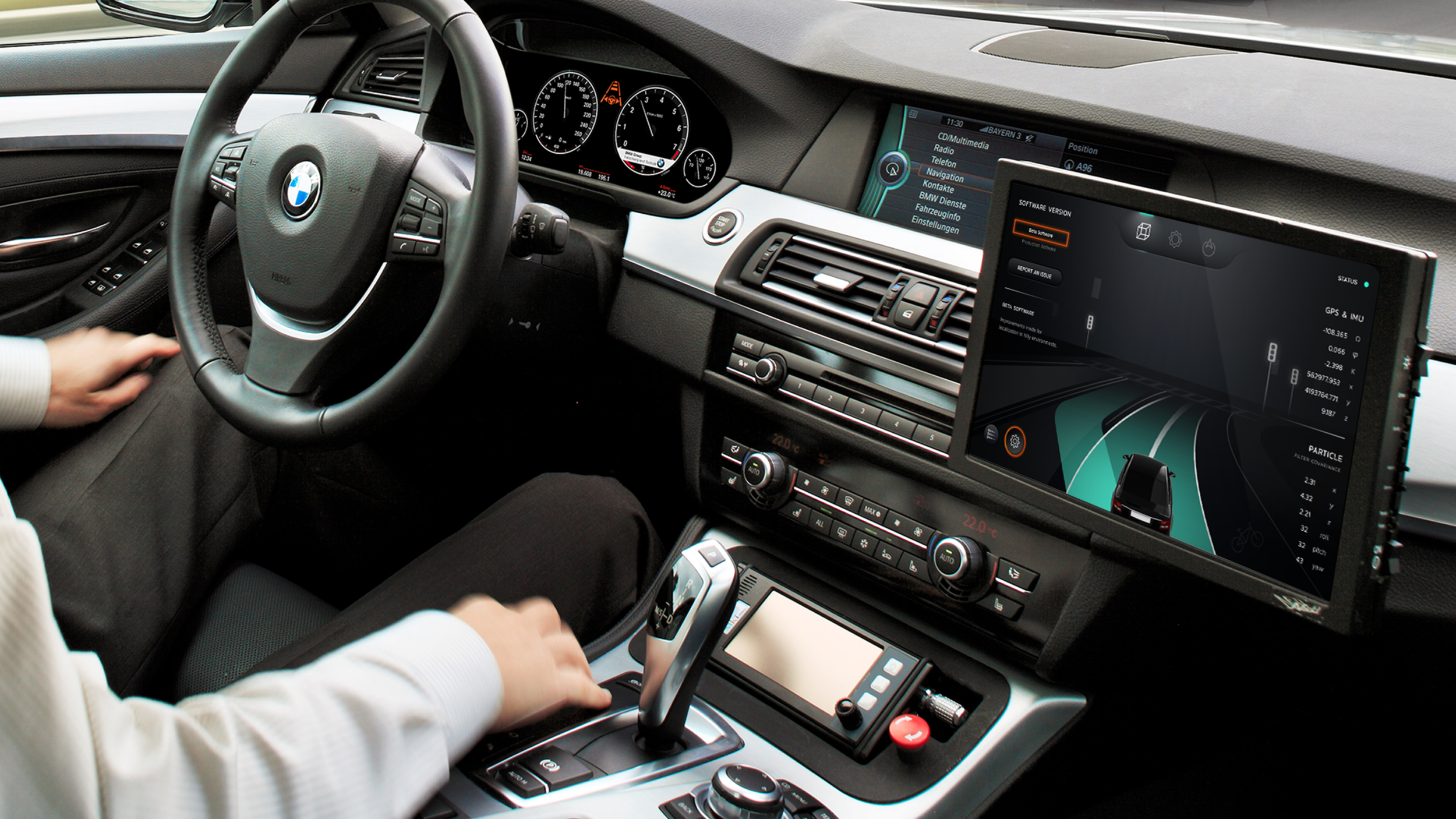
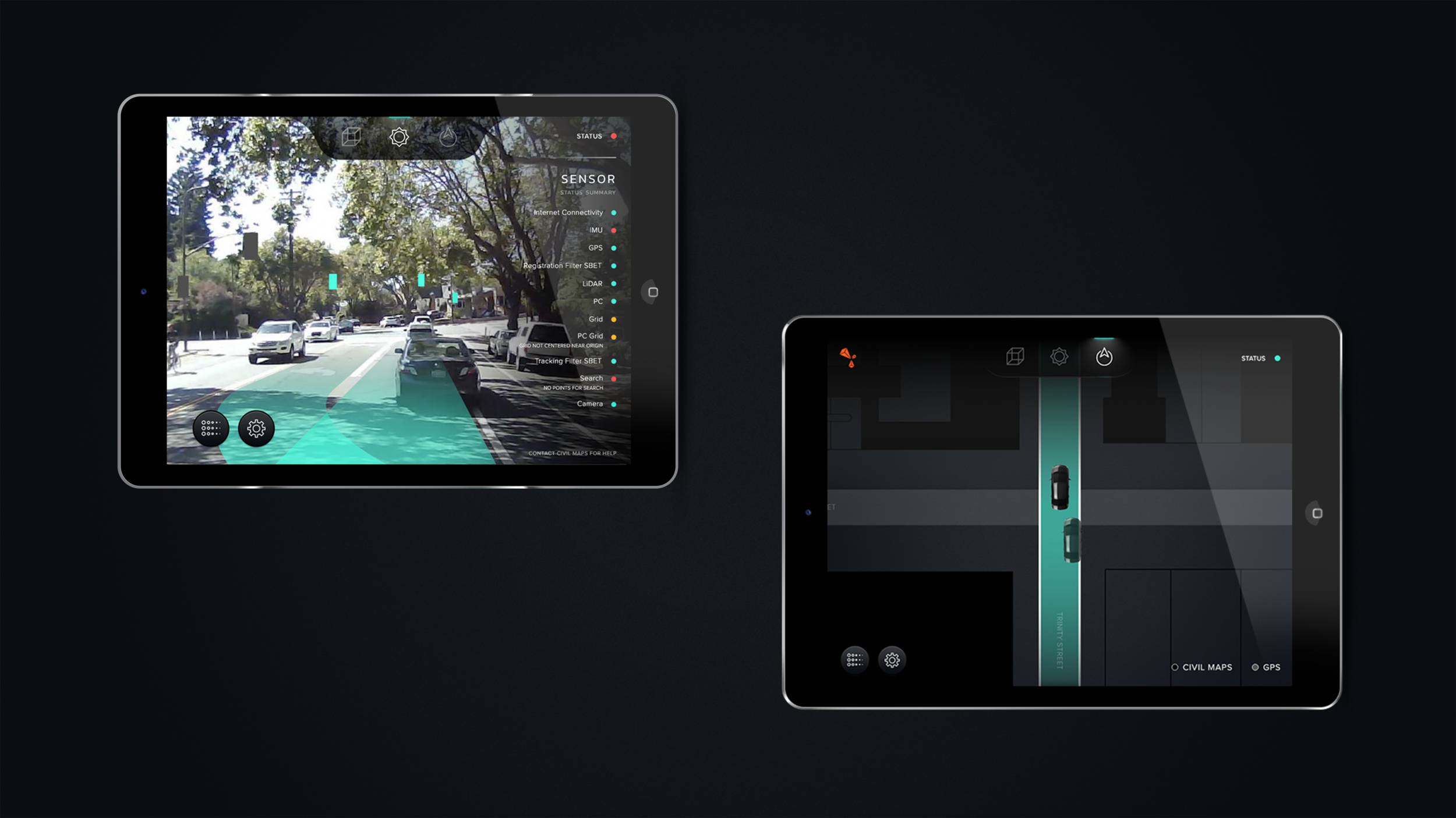
HMI (Human Machine Interface)
These screens are used primarily by the Research Drivers who are collecting the data for the mapping software. The wireframe I was given is actually what the program originally looked like for the mapping software beforehand. The new task was to not only create a more compelling visual for the driver, but to also organize information in a way that could be easily digestible while driving.
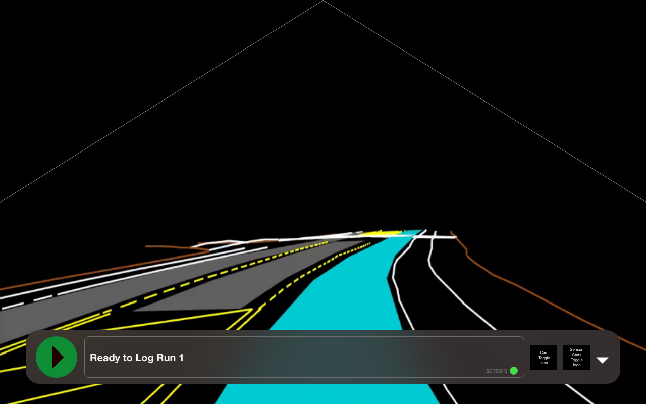
ORIGINAL INTERFACE
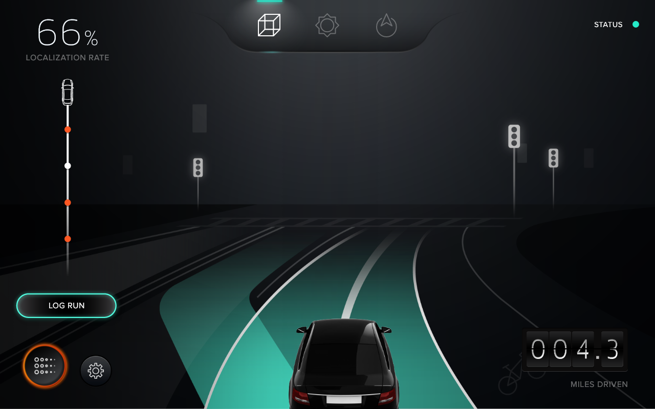
VISUAL DESIGN
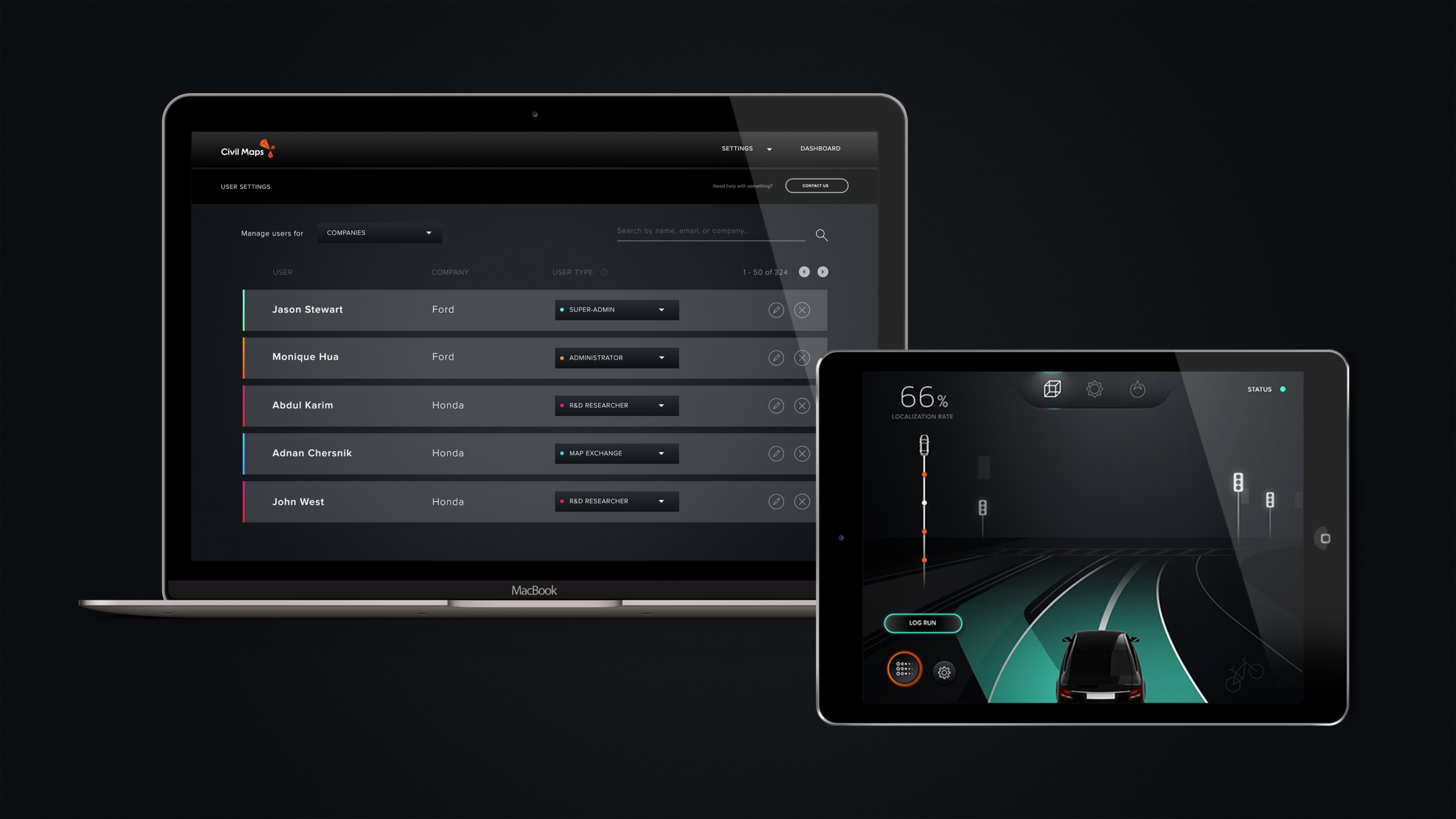
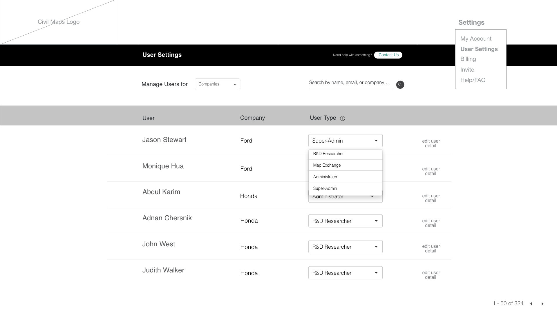
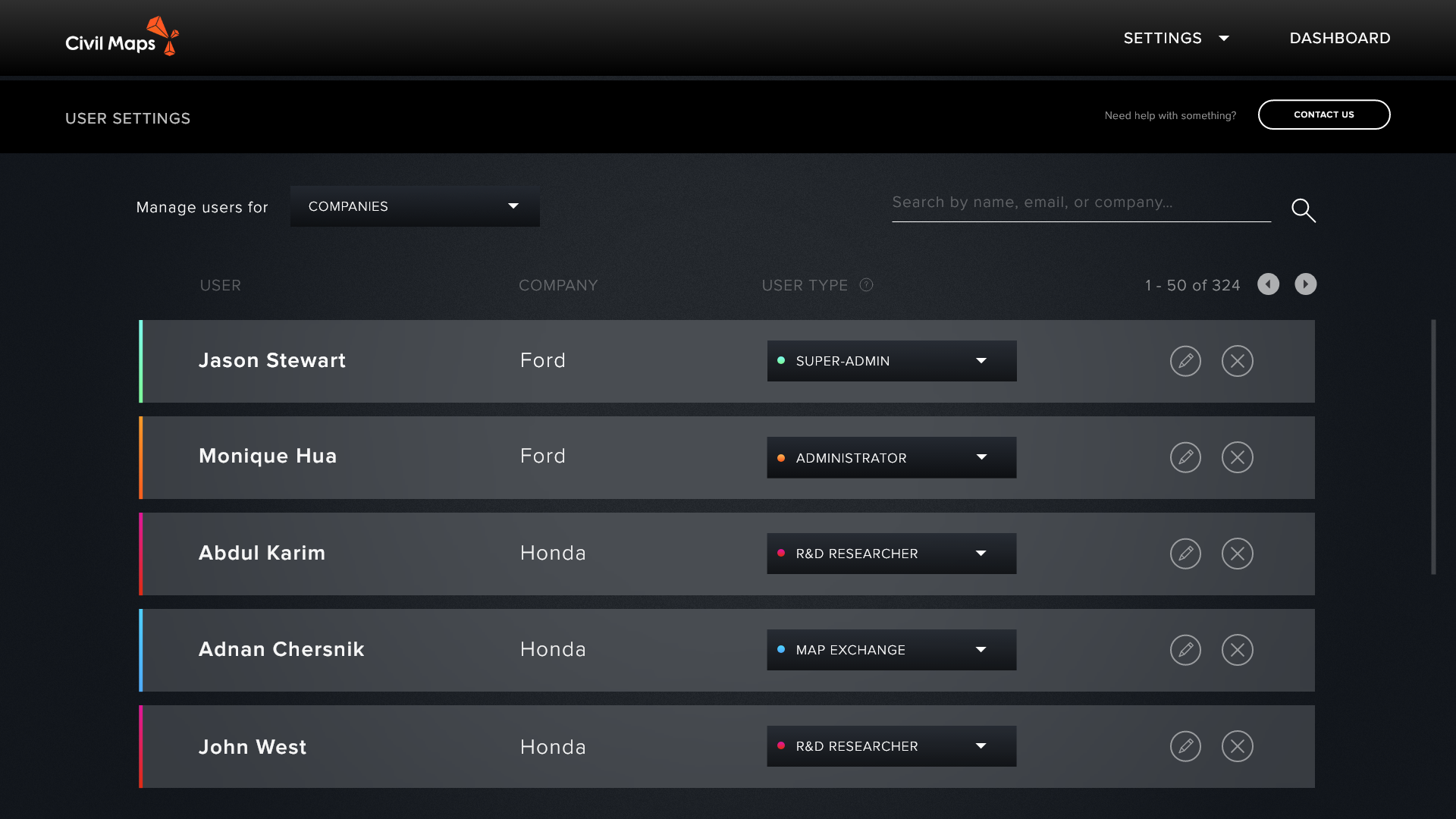
User Settings
This screen’s primary function allows for Civil Maps to manage their user base, and organize them through various filters such as name, car company they work for and their user type.
WIREFRAME
VISUAL DESIGN
Final Product